Clearwater, Florida

support@landprecision.com

(727) 796-2737
35 + Years of Surveying

LiDAR Drone Surveying
Advanced LiDAR Mapping for Commercial Land Development
Land Precision Corporation provides professional Drone LiDAR Surveying services throughout Florida, delivering highly accurate, survey-grade data for commercial development, infrastructure, engineering, utility, and land planning projects. By combining over 35 years of surveying expertise with cutting-edge drone and LiDAR technology, we help developers, engineers, contractors, and property owners make smarter decisions, reduce project risk, and accelerate project timelines.
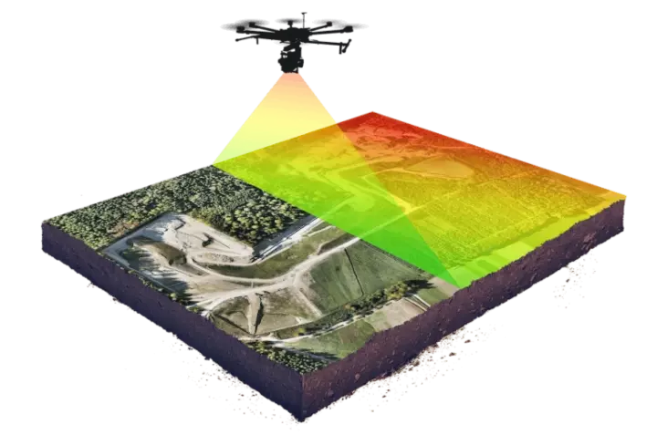
LiDAR (Light Detection and Ranging) technology uses laser pulses to collect millions of highly accurate data points across a project site, creating detailed 3D models, topographic maps, and terrain datasets with exceptional speed and precision. Unlike traditional aerial mapping methods, LiDAR can penetrate vegetation and capture accurate ground elevations beneath tree canopy, making it an ideal solution for Florida’s heavily wooded, environmentally sensitive, and difficult-to-access properties.
Faster Data Collection. Better Project Decisions.
Traditional surveying methods can require significant field time to collect data across large or challenging sites. Drone-mounted LiDAR dramatically improves efficiency by collecting dense, high-accuracy datasets in a fraction of the time. This allows project teams to quickly identify site constraints, drainage patterns, elevation changes, flood-prone areas, utility corridors, and development opportunities before construction begins.
The result is better planning, improved design accuracy, reduced field costs, and faster project delivery.